Dimensions in Geospatial Modeling

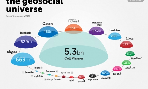
“Space” and “Time” are of great importance in today’s times more than ever before. Our cities are expanding, land is reducing, our natural and social environment is changing. Nothing seems permanent anymore.

Driving around one of India’s great cities, Mumbai gives you a great sense of this change. Where newer buildings are coming up, the great old slums of Bombay still exist.

Mumabi City: Slums and Modern buildings
Mumbai City: Slums and Modern buildings

Even a seemingly slight change in the city, causes the planners of this great city to consider so many factors, when planning any new infrastructure or maintaining the old ones. Take travel for example. Mumbai’s local train transport system has been the backbone of connectivity in this great city.

Crowded local trains in Mumbai

But are our trains getting less crowded by day? The city is still expanding, with increasing population and the capacity of our roads decreasing, time is never going to increase. Time has to be made out of our busy schedules, to travel the vastness of this city, eventhough there is traffic, there are crowds on our trains, buses and our roads. People still have to get to work on time, children need to get to school, supplies for this great city have to be delivered, and deadlines have to be met. It brings it down to the dimensions of space and time, and a number of factors, environmental, political and social that affect these dimensions.

Geographic information since the beginning has helped us understand space. Now with advancements in Geospatial technologies, we are able to quite accurately model and depict geographic information in the context of spatial (space) and temporal (time) dimensions. Geographic information can help visualize our space in 3d, and to add to that we have time.

Example of using a 3D GIS model used for Urban Planning

Temporal aspect of geographic data, is so significant in our time. Geographic data collected over years, and decades, along with other non-spatial information, not only gives us a great understanding of land use and climatic changes but also helps us predict such changes in future. It is this depiction of our 3 dimensional space along with time, that gives rise to our 4D Geospatial information. And to add to this, is also a new dimension, which is scale.The scale factor helps us model changes better in the context of specific localities, or a specific country or  countries all over the world.

Land Use Land Cover Changes over years, with the help of classification in GIS

The advancements in capturing geographic information, through remote sensing and surveys, and the advancements in our ability to model these dimensions, along with so many other, helps our governments, and city planners effectively tackle changes in our space.

LiDAR Mapping and trends

Light Detection and Ranging (LIDAR) is an airborne mapping technique, which uses a laser to measure the distance between the aircraft and the ground.
This technique of surveying has gained great significance in the past few years, with a lot of applications in the fields of Agriculture, Forestry, Military, Soil Science, Atmospheric Research, Urban Mapping etc.
Lidar uses ultraviolet, visible, or near infrared light to image objects. It can target a wide range of materials, including non-metallic objects, rocks, rain, chemical compounds, aerosols, clouds and even single molecules. A narrow laser-beam can map physical features with very high resolutions of up to 30 cm/px.

LiDAR mapping

Data

Wondering where the best places are to look for LiDAR data to download? Here they are!

  • Wikipedia: US LIDAR A page devoted to all known US state- and county-wide collections; perhaps an “all countries with LIDAR” wikipage can’t be too far behind?
  • NOAA’s LDART Page This is the most straightforward place to find LIDAR data readily available for downloading, but in keeping with NOAA’s mission, the focus is heavily on data from states that have at least some coastline. Scroll down a bit on this page to see list of states represented.
  • CLICK (USGS) The USGS Center for LIDAR Information Coordination and Knowledge (CLICK); see their Data Viewer tab
  • NOAA’s State Projects Page Select states of interest in the “Projects in My State” pull-down menu to ferret out clues about which state agencies *might* have data that they *might* be willing to share with you
  • USGS Seamless Data Distribution Service This is increasingly the main (federal) repository for LiDAR info, but using the application takes patience.
  • OpenTopography Data, DEMs, and some tools; not that much data yet, but seems to have the right ideas and has received NSF $ to beef up
  • LiDAR Data Portal Over 1 million sq km of already-collected LiDAR data and derived information, either free or for sale at nominal cost
  • USDA Data Gateway Although bulk of data is NAIP imagery, some LiDAR-based elevation info is here; see Get Data button
  • Puget Sound LIDAR Consortium Folks interested in Western Washington state can get LIDAR data here from this productive consortium

http://www.lidarbasemaps.org/

http://data.gov.uk/dataset/lidar-digital-surface-model

http://www.lidar-uk.com/usage-of-lidar/

Trends GeoSocial Universe

Hello everyone! Welcome to the world of Geospatial trends!

Now some of you reading this may a lot about trends and some of you may not, so we’re going to attempt to enlighten all of you.

Here goes

Meaning of Geospatial?

Google it (yes I’m googling it)

Answer:

Screen Shot 2015-05-03 at 8.02.13 pm

We know you’re probably experts in googling so lets not get into that.

here are some of the trends as of 3/May/2015 Have a look. The websites references have also been given.

Lets get you started and help you shift through the content on GIS

http://www.dr4ward.com/dr4ward/2011/05/current-size-comparison-of-the-major-social-networks-social-geolocation-apps-infographic.html#

6a00e54fd9f0598833014e88a908c0970d-800wi 6a00e54fd9f059883301538eb58c95970b-800wi 6a00e54fd9f0598833014e88a90ab1970d-800wi

Yes Geospatial Trends are everywhere. Think life and you have GIS connected to it.

This was a peek at GeoSocial Universe. Have a look at this and let us know what you think!

More later

all that's happening in the world of GIS